




AFTrack-Lite - GPS Tracking

Deskripsi AFTrack-Lite - GPS Tracking
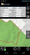
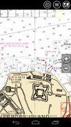
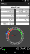
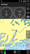
AFTrack is the display for your navigation and activates the world of hiking, biking, sailing, geocaching or more for your phone. The program handles tracking with smart and fixed logging features. If needed it sends reports online or via SMS, it receives SMS position messages and show it as a waypoint. It exports tracks and waypoints. Uses maps online and offline and more.
Features
GPS and other input
- different gps sources: internal gps, internal with NMEA, bluetooth gps direct, USB gps, online gps over Wifi/3G, NMEA file
- read NMEA, GpsD json, Signal K json
- work as gps daemon (nmea or json, port 2947 only)
- share position (replaces standard gps provider)
- connection with AIS server (NMEA format)
- altitude correction (automatic or manual) and Kalman filter
- pressure usable for altitude (if available)
- pressure start altitude editable
- automatic correction over weather server (needs net connection)
Tracking
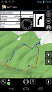
- collect track data
- show routes or tracks in up/down hill colors
- export tracks to GPX, KML, OVL, IGC format and send or upload it
- import route data - GPX, TCX or KML format
- import, export way points - GPX or KML format
- import areas from KML format
- use a kml.txt format to send exports direct via bluetooth
- design a route or an area on the map
- design a route using BRouter offline data, with Inland waterway
- design a route using wind information and polar data
- edit a route or an area on the map
- merge some routes
- copy way points to route
- get new way point from bearing, map or position
- add predefined way point collection to map
- revers routes
- Routing in a corridor
- off road routing along the line
Maps
- online maps - pool editable, tile or WMS based
- offline maps - OSZ format build by MobileAtlasCreator
- offline maps - SQLite formats mbtiles and sqlitedb build by MobileAtlasCreator and/or Maperitive
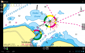
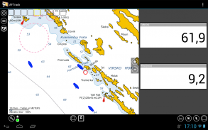
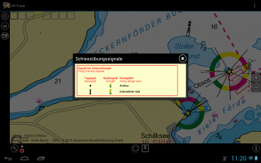
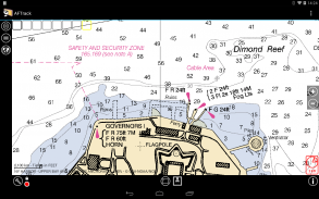
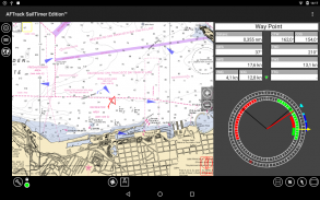
- offline maps - BSB3 format for marine navigation
- offline maps - NV digital for marine navigation
- offline maps - mapsforge vector format - with extra xml layouts usable (V4)
- offline maps - mph/mpr format
- use offline maps from jpg, png or bmp files
- use offline maps with calibration file map, gmi, kml, kal, cal, pwm, tfw or jpr format
- make own calibration for a bitmap
- seamless maps display when using OSZ or SQLite tile container
- map selector to have quick access to maps
- map scan for a defined folder and sub folder
- map overlays - online pool editable
- map offline overlays - in mbtiles 'overlay' format
- scaling charts 2x/4x
View
- wind indicator for the map or position center
- display depth - if available
- display AIS information - if available
- display ADS-B (air plane) information - if available
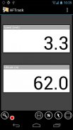
- vario display
- vario sound
- alarm on reached POIs
- set anchor alarm for the current position
- set anchor alarm for a way point that receives positions from a gps tracker
- save and restore settings
- send waypoint or anchor alarm to Android Wear
Online
- Online position sending for live tracking
- Online receive way point positions from a GpsGate server
- works as SMS provider (needs a plugin)
- short message position sending
- short message position receiving
- short message from GPS tracker TK102, TK102-2, TK102 clones, TK-Star, DNT, ELRO, GEODOG, Benefon ESC, Benefon Trackkeeper NT, WondeProud spt10, Tracker from tracker.fi, Wo-ist-Lilly or SmartcomGps
- text storage for short messages e.g. for Xexun tracker
- set position from short message
- send sms note to other AFTrack instance and get position back
- collect short messages to a track, single and multi-tracking
- getting way point positions from a GpsGate server
Notice: the SMS features are removed by Google.
Please send remarks to afischer@dbserv.de
The lite version differences
- no automatic position sending
- no template sending via short message
- loads only three offline maps in automatic mode
- has a start screen
- has inside advertising
- limited export
- no multi track colors
AFTrack adalah tampilan untuk navigasi Anda dan mengaktifkan dunia hiking, bersepeda, berlayar, geocaching atau lebih untuk ponsel Anda. Program ini menangani pelacakan dengan fitur logging yang cerdas dan tetap. Jika perlu mengirimkan laporan secara online atau melalui SMS, ia menerima pesan posisi SMS dan menunjukkannya sebagai titik arah. Ini mengekspor trek dan titik arah. Menggunakan peta online dan offline dan banyak lagi.
fitur
GPS dan input lainnya
- Sumber gps berbeda: gps internal, internal dengan NMEA, bluetooth gps langsung, USB gps, gps online melalui Wifi / 3G, file NMEA
- baca NMEA, GpsD json, Signal K json
- bekerja sebagai gps daemon (nmea atau json, port 2947 saja)
- Posisi berbagi (menggantikan penyedia gps standar)
- koneksi dengan server AIS (format NMEA)
- koreksi ketinggian (otomatis atau manual) dan filter Kalman
- tekanan yang dapat digunakan untuk ketinggian (jika tersedia)
- Tekanan mulai ketinggian dapat diedit
- Koreksi otomatis atas server cuaca (perlu koneksi internet)
Pelacakan
- Mengumpulkan data lintasan
- menunjukkan rute atau trek dalam warna bukit naik / turun
- Mengekspor trek ke GPX, KML, OVL, format IGC dan mengirim atau mengunggahnya
- Impor data rute - Format GPX, TCX atau KML
- impor, ekspor cara poin - format GPX atau KML
- Mengimpor area dari format KML
- Gunakan format kml.txt untuk mengirim ekspor langsung melalui bluetooth
- mendesain rute atau area pada peta
- rancang rute menggunakan data offline BRouter, dengan jalur air Inland
- merancang rute menggunakan informasi angin dan data kutub
- Edit rute atau area pada peta
- menggabungkan beberapa rute
- salin titik jalan ke rute
- dapatkan titik jalan baru dari bantalan, peta atau posisi
- Tambahkan koleksi titik jalan yang telah ditentukan sebelumnya ke peta
- membalikkan rute
- Routing di koridor
- Routing off road di sepanjang jalur
Peta
- Peta online - kumpulan kolam yang dapat diedit, ubin atau berbasis WMS
- Peta offline - Format OSZ dibuat oleh MobileAtlasCreator
- Peta offline - Format SQLite mbtiles dan sqlitedb build oleh MobileAtlasCreator dan / atau Maperitive
- Peta offline - Format BSB3 untuk navigasi laut
- Peta offline - NV digital untuk navigasi laut
- Peta offline - Format vektor mapsforge - dengan tata letak xml tambahan dapat digunakan (V4)
- Peta offline - format mph / mpr
- Gunakan peta offline dari file jpg, png atau bmp
- Gunakan peta offline dengan peta file kalibrasi, gmi, kml, kal, kal, pwm, tfw atau format jpr
- membuat kalibrasi sendiri untuk bitmap
- Peta mulus ditampilkan saat menggunakan wadah ubin OSZ atau SQLite
- pemilih peta untuk memiliki akses cepat ke peta
- Pemindaian peta untuk folder dan sub folder yang ditentukan
- overlay peta - pool online dapat diedit
- map overlay offline - dalam format 'overlay' mbtiles
- grafik penskalaan 2x / 4x
Melihat
- Indikator angin untuk peta atau posisi tengah
- Kedalaman tampilan - jika tersedia
- tampilkan informasi AIS - jika tersedia
- tampilkan informasi ADS-B (pesawat udara) - jika tersedia
- tampilan vario
- Suara vario
- alarm pada POI yang tercapai
- atur jangkar alarm untuk posisi saat ini
- atur jangkar alarm untuk titik jalan yang menerima posisi dari pelacak gps
- simpan dan pulihkan pengaturan
- Kirim waypoint atau anchor alarm ke Android Wear
On line
- Pengiriman posisi online untuk pelacakan langsung
- Online menerima posisi titik jalan dari server GpsGate
- berfungsi sebagai penyedia SMS (membutuhkan plugin)
- Pengiriman posisi pesan singkat
- Menerima posisi pesan singkat
- pesan singkat dari pelacak GPS TK102, TK102-2, klon TK102, TK-Star, DNT, ELRO, GEODOG, Benefon ESC, Benefke Trackkeeper NT, WondeProud spt10, Pelacak dari tracker.fi, Wo-ist-Lilly atau SmartcomGps
- penyimpanan teks untuk pesan pendek mis. untuk Xexun tracker
- atur posisi dari pesan singkat
- Kirim catatan sms ke instance AFTrack lainnya dan dapatkan posisi kembali
- Mengumpulkan pesan singkat ke trek, tunggal dan multi-pelacakan
- mendapatkan posisi titik jalan dari server GpsGate
Perhatikan: fitur SMS dihapus oleh Google.
Silakan kirim komentar ke afischer@dbserv.de
Perbedaan versi lite
- tidak ada pengiriman posisi otomatis
- tidak ada pengiriman template melalui pesan singkat
- Memuat hanya tiga peta offline dalam mode otomatis
- Memiliki layar mulai
- Memiliki iklan di dalam
- ekspor terbatas
- tidak ada warna multi track


